
When Streets Think for Themselves Smart Traffic Management in the Connected City
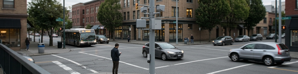
At rush hour, city streets often feel stuck in yesterday’s routines while vehicles, buses, cyclists, and pedestrians compete for limited space. A new layer of sensing devices, edge processing, and cloud-based control is quietly reshaping intersections, tuning signals dynamically and easing day-to-day journeys.
This story is part of Esgamesol's practical reading library across everyday topics.
When Streets Start Paying Attention
From rigid cycles to responsive movement
In a traditional junction, lights change on a fixed schedule, regardless of whether a queue is stretching around the block or only a single car is waiting. A responsive junction behaves more like a living system: it pays attention to current demand, then adjusts who gets to go next. Within safety limits, green time can be stretched, shortened, or even skipped if nobody is there. Over thousands of small adjustments each day, this tends to cut the worst delays, smooth out the stop‑start pattern, and make everyday trips feel calmer. The aim is not endless priority for one direction, but a fairer distribution of waiting time based on what is actually happening on the ground.
How intersections “sense” what is going on
Awareness starts with detection. Loops in the pavement feel vehicles roll over them; radar units see movement through rain or fog; cameras spot queues, turning patterns, bikes and people on foot. Newer setups also learn from navigation apps and in‑vehicle systems that share anonymous speed and journey data. Together, these sources build a live picture of how busy each approach is and how fast traffic is clearing once the light turns green. If the data show that a side road is empty, there is no reason to waste precious seconds on an unnecessary phase. If a long line of vehicles is creeping forward, the system can hold the green a little longer before switching.
Scaling from one junction to a whole corridor
A single intelligent junction can fix a local annoyance; several working together can reshape an entire route. When signals along a corridor share data through a central platform, they can line up their timing so that groups of vehicles released from one junction arrive at the next just as it turns green. This idea of a moving “green wave” has been around for decades, but live data make it far more flexible. If speeds fall due to rain, a crash, or heavy pedestrian activity, the offsets between signals can be tweaked automatically, rather than waiting months for an engineer to rewrite a plan.
| Corridor setup type | Typical advantages | Typical trade‑offs |
|---|---|---|
| Isolated smart junctions | Quick wins at obvious bottlenecks; simpler deployment | Benefits may fade a block away; limited corridor consistency |
| Fully linked corridor | Smoother trips end‑to‑end; easier to support buses and freight | Requires coordination rules and more monitoring effort |
Thoughtful use of these patterns lets transport teams upgrade key routes first, then gradually connect them into a broader, city‑wide system.
The Data Layer Under the Asphalt
What roads measure in real time
Modern control rooms receive a constant flow of information: how long queues are, how often approaches max out, how quickly people cross, and where speeds suddenly collapse. Sensors near junctions capture arrivals and departures; mid‑block devices track progression between signals. Anonymous feeds from vehicles and phones fill gaps where no roadside equipment exists. Instead of relying on a handful of manual counts each decade, managers can see how traffic behaves on wet days, holidays, school runs, and event nights. This richer picture supports more precise decisions about where seconds of green time matter most.
Turning raw numbers into decisions
Raw data alone do not tell a compelling story. Software filters out faulty readings, stitches together sources, and highlights patterns that humans can act on. Dashboards show routes where typical delay is creeping up, streets where near‑miss indicators suggest safety problems, and junctions where pedestrian waits routinely feel unfair. Some adjustments happen automatically: if a detector shows repeated oversaturation, the local controller may lengthen that phase within preset limits. Bigger changes—such as altering progression on an entire corridor—are usually tested in off‑peak periods, reviewed against performance metrics, then refined.
| Data insight | Possible operational response | Who benefits most |
|---|---|---|
| Repeated long queues at a key junction | Retune splits, change lane use, or adjust progression | Drivers, freight operators |
| High pedestrian waiting plus short walk times | Longer crossing phases, slower vehicle progression | People walking, mobility‑impaired users |
| Unreliable bus running times on a corridor | Timed priority at signals, revised stop spacing | Transit riders |
This loop—measure, adjust, review—helps avoid guesswork and keeps changes aligned with local priorities.
Watching out for reliability and bias
Smart control is only as good as the information it receives. A misaligned camera, a broken loop, or a sensor that misses cyclists in dark clothing can distort the picture. Regular health checks, targeted calibration, and audits of how different user groups are detected are essential. Without them, a system might unintentionally favor fast‑moving vehicles over slower walkers or people on bikes. Many teams now combine automated reports with on‑street observation to confirm that numbers match lived experience, especially in busy mixed‑use areas.
Signals That Adapt on the Fly
Adjusting greens instead of rewriting the road
Building more lanes is costly and often unpopular in dense areas. Smarter timing offers another way to squeeze more capacity from existing space. Adaptive logic inside controllers constantly updates three elements: total cycle length, how much green each movement receives, and the offset between neighboring junctions. When volumes rise, the cycle can lengthen slightly to push more vehicles through; when demand falls, shorter cycles cut needless waiting. The art lies in setting generous but firm boundaries so that no approach, mode, or neighborhood is starved of service.
Keeping people walking and cycling in view
Early traffic control often treated those on foot or on bikes as afterthoughts. Modern setups try to reverse that. Detection zones near crosswalks can estimate how many people are waiting, then offer an earlier or longer walk phase when crowds build. Some sensors can recognize slower movement—such as someone using a frame, cane, or pushing a stroller—and hold the walk signal long enough that nobody feels forced to rush. For cyclists, dedicated detection lets a line of riders trigger or extend a phase without needing a car in the loop, and green waves can be tuned around typical cycling speeds, not just those of vehicles.
Supporting buses and emergency services
Signals can also act as quiet allies for public transport and first responders. Buses approaching behind schedule can send a request for a small extension of green or a shorter red, shaving critical seconds without overturning the whole plan. For emergency vehicles, pre‑planned routes can be cleared through a sequence of intersections, turning conflicting movements red early and holding a protective green tunnel. Properly bounded rules keep these tools from overwhelming other users, but applied carefully they can make high‑impact trips faster and more reliable.
Connected Roads, Connected Choices
Coordinating whole neighborhoods, not just main roads
Real journeys bounce between local streets, feeder routes, and big arterials. If each set of signals optimizes for its own flow alone, queues can simply migrate from place to place. Connected control platforms allow managers to look at an area as a whole. If a busy corridor is close to gridlock, side streets feeding it can be slightly throttled, while alternative paths get more green. If rat‑running is pushing unwanted traffic past homes and schools, side‑street signals can be tuned to discourage cut‑throughs without blocking local access. These broader strategies aim to share both benefits and burdens more evenly.
Giving travelers better information
When road conditions are updated continuously, journey planners and in‑vehicle guidance can do more than just warn of a traffic jam. They can estimate how many extra minutes a red‑heavy corridor might add, suggest alternatives where signals have been re‑timed to offer a smoother ride, or flag streets that currently favor buses and walking over general traffic. Over time, such feedback can gently steer demand away from overloaded links and toward routes and modes the network can support more comfortably.
Designing with people, not just vehicles, in mind
A technically impressive system that ignores how streets feel will quickly meet resistance. Residents care about noise outside bedroom windows, parents worry about crossings near schools, and business owners think about delivery access. Including these voices when setting performance targets—such as acceptable delay, minimum walk times, preferred cycling speeds, or limits on diverted traffic—keeps automation aligned with human expectations. In many places, that means actively using smart control to create calmer main streets, safer junctions, and corridors where buses, bikes, and people on foot are genuinely welcome.
What Smarter Streets Mean Day to Day
Less drama, more predictability
For most people in English‑speaking cities, the most tangible effect of these systems is subtle: fewer puzzling reds at empty junctions, shorter extreme delays, and a general sense that familiar routes behave more consistently. Even when peak congestion does not disappear, travel times often become more predictable. That reliability helps commuters plan departure times, lets freight operators schedule drops more accurately, and makes it easier for families to juggle school runs, appointments, and work.
Quieter engines, cleaner air, calmer behavior
Smoother flow reduces hard acceleration and sudden braking. Engines idle for shorter periods, cutting local pollution near busy stops and crossings. Drivers who meet a run of well‑timed lights feel less pressure to speed between signals or jump late ambers, which supports safer habits. Over months and years, these small gains accumulate: slightly lower emissions, fewer minor collisions, and less wear and tear on vehicles using heavily signaled corridors.
A foundation for future changes
Perhaps the biggest shift is invisible: streets become measurable and adjustable in near real time. That capability lays the groundwork for bigger changes, from new bus‑only segments and protected cycleways to rebalanced main streets that give more space to people on foot. When transport teams can see how those changes affect movement almost immediately, they can iterate instead of locking in a single design for decades. In that way, smarter control is less about gadgets and more about giving cities a flexible toolkit to keep daily journeys workable while aiming for safer, fairer, and more sustainable movement over the long term.
Q&A
-
How do Connected Mobility Systems improve coordination between different transport modes?
Connected Mobility Systems integrate data from cars, buses, trains, bikes, and pedestrians into a single platform, enabling synchronized timetables, dynamic routing, and seamless transfers that cut waiting times and reduce overall network congestion. -
What role does Urban Signal Optimization play in reducing emissions?
Urban Signal Optimization adjusts traffic lights using live traffic flow analytics, shortening idling at junctions, smoothing acceleration and braking, and prioritizing greener modes, which together significantly lower fuel consumption and urban CO₂ output. -
Why is Real-Time Transport Data critical for Intelligent Road Networks?
Real-Time Transport Data feeds current speeds, incidents, and demand into control systems, allowing Intelligent Road Networks to reroute traffic, adjust lanes or speed limits, and respond instantly to disruptions instead of relying on static historical patterns. -
How does Traffic Flow Analytics support planning of Digital City Infrastructure?
Traffic Flow Analytics reveals long-term bottlenecks, peak patterns, and latent demand, guiding cities on where to add lanes, bus priority, bike corridors, or smart parking, ensuring infrastructure investments match actual mobility behavior. -
What cybersecurity measures are essential for Digital City Infrastructure in mobility?
Digital City Infrastructure must use encrypted communications, strict access control, network segmentation, anomaly detection, and regular penetration testing to protect connected mobility systems from data breaches and malicious disruptions.