
Robots in the Wild: How Field Science Is Changing on Wheels and Wings
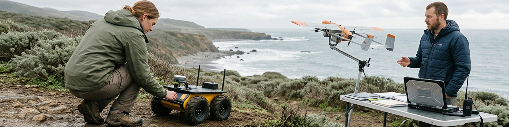
Across deserts, glaciers, forests, and disaster zones, mobile machines are quietly reshaping how on‑site science is done. Equipped with advanced cameras, laser scanners, and chemical sniffers, they venture where people struggle to go, gathering precise measurements and building detailed 3D views of fragile or dangerous landscapes.
This story is part of Esgamesol's practical reading library across everyday topics.
Where Mobile Machines Go When People Shouldn’t
Hazard zones, steep slopes, and unstable ground
Risky locations are often the most scientifically interesting: landslide‑prone hillsides, damaged industrial sites, crumbling cliffs, or earthquake‑shaken structures. In many of these places, a single misstep can mean serious injuries, so researchers try to limit how long people stay on site. Small tracked or wheeled machines step into that gap. They crawl across loose rubble, inch along unstable ledges, and approach toxic plumes while operators remain at a safe distance. Onboard imaging and gas‑sniffing instruments show which structures are shifting, where leaks concentrate, and how cracks evolve over time. Because machines do not suffer from fatigue or exposure limits, they can watch a risky zone for hours or days, capturing the slow changes that drive collapse, erosion, or contamination.
Marshes, ice, coastlines, and open water
Some environments are less obviously dangerous but still punishing for people. Marshes and wetlands can swallow boots, crush delicate plants, and hide deep channels under lush vegetation. Floating or low‑ground‑pressure platforms skim across these surfaces, sampling water quality, salinity, and plant cover without trampling habitats. On ice or snow, compact tracked carriers cross crevasses and drifted ridges to survey thickness and melt patterns. Along coasts and at sea, surface craft and diving machines trace currents, waves, and sediment plumes across wide areas that would demand fleets of boats. In each case, the machines extend both reach and endurance, letting science teams track these shifting interfaces between land, water, and air with far less physical strain.
| Field setting | Typical robot body | Main strengths | Main trade‑offs |
|---|---|---|---|
| Rubble and steep slopes | Small tracked ground unit | Close‑up imaging near hazards, steady presence | Limited speed and coverage range |
| Wetlands and marshes | Amphibious or floating rover | Minimal habitat damage, fine‑scale sampling | Challenging navigation through vegetation |
| Coastlines and open water | Surface craft or diving unit | Broad‑area coverage, repeatable transects | Complex recovery and maintenance |
Caves, tunnels, and other enclosed spaces
Underground passages, lava tubes, abandoned tunnels, and service shafts hide information about geology, fluids, and built structures. They are also cramped, dark, and sometimes poorly ventilated. Compact rolling or walking machines fitted with bright lights, laser scanners, and gas sensors move through these voids more safely than human explorers. They squeeze through narrow gaps, peer behind collapses, and build 3D models of roofs and walls. Those models show where ceilings sag, water seeps in, or gas pockets accumulate. With careful planning, machines can revisit the same routes repeatedly, turning a dangerous, unknown interior into a monitored space where changes are caught early.
The Sensing “Nervous System” On Board
Vision, depth, and thermal views
Camera systems are usually the first layer of perception. High‑resolution color views give a familiar record of rock faces, vegetation, infrastructure, and wildlife. Paired or structured‑light cameras estimate distance, turning flat images into depth maps that reveal slopes, overhangs, and obstacles. These depth cues matter both for safe movement and for later analysis of erosion, canopy height, or ice retreat. Beyond visible light, thermal imagers highlight warm springs, stressed crops, leaking pipes, or subtle microclimates that never show up in ordinary photos. By stacking color, depth, and heat information, researchers can see not only what is there but also how it is shaped and where energy flows across a landscape.
Lasers, sonar, and precise shape sensing
Many platforms add laser‑ or sound‑based ranging to capture geometry directly. Spinning units on land or in the air send out pulses and read the returning signal, building dense point clouds of cliffs, tree trunks, caves, and structures. Underwater, sonar plays a similar role, cutting through murky water to trace seafloors, reef walls, or wrecks. When fused with motion estimates, these measurements become detailed 3D reconstructions. Scientists can then measure volumes of sediment, forest density, void sizes inside caves, or deformation of infrastructure without returning in person. Challenges remain: reflective water, blowing leaves, bubbles, and suspended particles can confuse sensors, so robust filtering and smart placement are part of every serious deployment.
Air, water, soil, and chemical probes
Images and shapes are powerful, but many questions depend on what flows through air, water, and soil. Field machines act as roaming stations for environmental probes that log temperature, humidity, wind, pressure, pH, turbidity, and targeted gases. Rolling units track dust or fumes across industrial yards or volcanic slopes; flying platforms sniff invisible plumes above tree canopies; floating craft tow instruments that taste gradients in salinity, oxygen, or nutrients along estuaries. Because the platforms move, they sample whole cross‑sections and vertical profiles instead of a handful of fixed points. That mobility turns static readings into full 3D “fields” of conditions, revealing hidden boundaries and mixing layers that strongly shape ecosystems.
Touch, vibration, and internal feedback
For robots that step, climb, or manipulate, touch is as important as sight. Force sensors in legs and wheels reveal when ground becomes soft, slippery, or hollow. Tactile pads in grippers report how firmly an object is held, helping avoid crushing fragile samples or dropping tools. Vibration signatures from motors and frames change with sand, rock, mud, or ice underfoot, allowing terrain type estimates even when vegetation hides the surface. Internal motion sensors track tilt, acceleration, and joint positions, so controllers can react quickly to slips or shifts. Together, these non‑visual channels let machines “feel” their way through brush, boulders, and tight spaces, going beyond simple obstacle avoidance toward more confident, context‑aware movement.
From Raw Readings To Maps People Can Use
Local navigation when global fixes fail
Satellite signals are unreliable under dense trees, in canyons, inside buildings, underground, and underwater. That forces many platforms to rely on local cues instead of precise global coordinates. Cameras, ranging units, and inertial sensors build short‑range maps on the fly, tracking nearby rocks, trunks, floor patterns, or cave walls. The machine constantly updates its position within this local picture, allowing safe motion even when absolute location is fuzzy. For repeated routes, a “teach‑and‑repeat” strategy works well: an operator drives or pilots once while the system logs key features; later, the machine compares live sensor data to this record and follows roughly the same track on its own.
Building layered 3D models
As machines travel, every frame of data—images, point clouds, chemistry, forces—adds another tile to a growing mosaic. Software aligns overlapping views, corrects drift, and merges passes from different days or different platforms into unified models. Those models are more than pretty visualizations. They support measurement of slope angles, roughness, canopy height, crack width, or flood marks. By revisiting sites, teams overlay new data on old, watching how cliffs retreat, dunes migrate, roots expand, or structures deform. Even modest robots can now generate digital twins of valleys, caves, reef sections, or industrial corridors at resolutions that once required large survey crews.
| Goal for a field campaign | Useful mapping strategy | Typical robot role |
|---|---|---|
| Track slow landscape change | Repeat 3D surveys along fixed routes | Follow taught paths with consistent sensors |
| Find emerging hazards | High‑frequency local re‑mapping | Patrol targeted zones and flag anomalies |
| Characterize complex habitats | Layered geometric and environmental maps | Sweep grids and adapt density where patterns emerge |
Managing limited bandwidth and heavy data
Remote sites rarely offer robust connections back to labs. Machines may need to operate with only intermittent low‑bandwidth links, so most processing happens on board or back at base. Teams choose carefully what to transmit live—summaries, alerts, thumbnail maps—and what to store to disk for later offload. Power and storage budgets push hard trade‑offs: ultra‑high‑resolution scans look attractive, but they eat battery and memory quickly. Many groups now design field plans around the analysis they actually need, setting sensor resolutions and revisit schedules to answer specific questions rather than collecting maximum detail by default. This focus keeps systems lighter, missions longer, and data piles more manageable.
How Human Field Teams Work With Their Robotic Colleagues
Planning campaigns around mixed crews
Adding ground or aerial platforms changes how expeditions are organised. Research leaders think not only about tents, sample kits, and safety gear, but also about launch spots, recovery zones, spare batteries, chargers, airspace rules, and transport for rugged cases. Roles shift: some team members focus on piloting and maintenance; others watch live feeds, mark interesting locations, and adjust routes as conditions unfold. When planned well, people and machines complement each other: robots scout, scan, and repeat long, dull transects; humans concentrate on delicate sampling, interpretation, and decisions when the unexpected appears.
Reading strengths, limits, and failure modes
Treating robotic output as flawless is tempting, especially when 3D models and colourful overlays look convincing. Yet outdoor sensing is full of blind spots. Shiny water, blowing branches, steam, dust, or bubbles can distort measurements. Cameras saturate in glare; ranging sensors struggle with fog; chemical probes drift over time. Experienced field users stay aware of these quirks, cross‑checking against manual readings or independent methods whenever possible. When a rover gets stuck or a drone is grounded by wind, those incidents become valuable feedback for designers: they reveal where algorithms assumed tidy conditions that rarely exist outside controlled spaces.
Who benefits right now, and what comes next
Today, the clearest gains appear in groups that regularly face either physical danger or exhausting logistics: teams monitoring unstable slopes, working around industrial hazards, mapping complex cave systems, or surveying remote coasts and reefs. For them, even simple machines that can follow a fixed route, carry a modest sensor pack, and repeat missions reliably make a big difference. Looking ahead, the trend is toward more flexible, user‑friendly platforms: systems that non‑specialists can configure, that gracefully switch between autonomous and guided modes, and that cope with weather, clutter, and sensor noise without fragile tuning. As that matures, machine partners will appear not only on spectacular expeditions, but across everyday field campaigns where careful mapping and gentle access matter just as much as heroics.
A New Normal For Outdoor Discovery
Fieldwork is quietly shifting from brief, high‑effort visits toward blended presence: people still hike, sail, climb, and dive, but machines now keep watch between those visits, returning again and again along known paths. Rolling, walking, flying, and swimming platforms extend reach into places that once stayed blank on maps or were visited only rarely. Rich sensing suites turn those forays into layered records of shape, movement, heat, chemistry, and sound. Used thoughtfully, these tools deepen understanding rather than replace human curiosity, giving researchers in English‑speaking regions and beyond a more detailed, persistent view of the living, changing world.
Q&A
-
What advantages do autonomous research vehicles offer over traditional field expeditions?
Autonomous research vehicles can operate continuously in harsh or remote environments, reduce human risk and logistics costs, and collect standardized, high-resolution data that improves the reliability and repeatability of scientific studies. -
How is remote data collection improving long-term environmental monitoring?
Remote data collection allows frequent, low-cost measurements over large areas, enabling early detection of ecological changes, better trend analysis, and real-time alerts for events like pollution spikes or habitat degradation. -
In what scenarios are environmental survey robots most effectively used?
Environmental survey robots excel in repetitive, wide-area tasks such as mapping coral reefs, monitoring forest health, tracking glacier changes, and inspecting agricultural fields without disturbing ecosystems. -
Why are robotic systems critical for hazardous site exploration?
Robots can enter toxic, radioactive, or structurally unstable sites where humans cannot safely go, using onboard sensors to map conditions, locate risks, and guide remediation strategies with minimal exposure. -
How do scientific mapping tools and sensor-guided robotics work together in research missions?
Sensor-guided robots feed real-time measurements into mapping tools, creating detailed 2D or 3D models of terrain, chemistry, or biology, which scientists then analyze to plan follow-up missions and refine hypotheses.